
HISTORY ONLINE 24/7/365
THE U.S. 1 GEOGRAPHY PAGE
Geography in U. S. History 1
When I taught U.S. History 1, one of the most challenging parts of the course for many students was the geography, most specifically the physical regions of North America. While the concept of regions to group similar areas that share similar charactaristics is important, sometimes how we draw up the regions or what charactaristics we emphasise can seem arbitrary or random, and the way the Virginia SOL does this can seem very random. This is an area U.S.1 students need to spend some extra time, but understanding the geography and climate of various regions of North America will help you understand the history, and how and why areas of the United States grew and developed the way they did.Resources:
CLICK HERE to get the “official map” from the Virginia Department of Education. TIP ONE: When you look at the offical map, you will notice the regions are labeled from nearest to farthest, from east to west, or from right to left. While I understand the logic behind that approach, we read from left to right, and when I started teaching it that way, students did far better memorizing the regions in order. TIP TWO: Use a mnemonic device or memory trick to help you remember the regions in order. The one that worked best for my students was: “Can Bill Remember Girls In Carolina Are Cute” and the first letter of each word was the first letter for a region from left to right: * Coastal Range * Basin & Range * Rocky Mountains * Great Plains * Interior Lowlands * Canadian Shield * Appalachian Mountains or Highlands * Coastal Plain TIP THREE: To keep from mixing up Coastal Range and Coastal Plain, remeber Pacific beaches are rocky and hilly like a mountain “Range” and Atlantic beaches are sandy and flat like a “plain.”Click Here to go to Videos:
SOL Info:
Continents are large land masses surrounded by water. Continents • North America • South America • Africa • Asia • Australia • Antarctica • Europe* *Note: Europe is considered a continent even though it is not entirely surrounded by water. The land mass is frequently called Eurasia. Oceans • Atlantic Ocean • Pacific Ocean • Arctic Ocean • Indian Ocean • Southern Ocean Geographic regions have distinctive characteristics. Geographic regions’ locations and physical characteristics • Coastal Plain o Located along the Atlantic Ocean and Gulf of Mexico o Broad lowlands, providing many excellent harbors • Appalachian Mountains o Located west of the Coastal Plain, extending from eastern Canada to western Alabama; includes the Piedmont o Old, eroded mountains (oldest mountain range in North America) • Canadian Shield o Wrapped around the Hudson Bay in a horseshoe shape o Hills worn by erosion and hundreds of lakes carved by glaciers • Interior Lowlands o Located west of the Appalachian Mountains and east of the Great Plains o Rolling flatlands with many rivers, broad river valleys, and grassy hills • Great Plains o Located west of the Interior Lowlands and east of the Rocky Mountains o Flat lands that gradually increase in elevation westward; grasslands • Rocky Mountains o Located west of the Great Plains and east of the Basin and Range o Rugged mountains stretching from Alaska almost to Mexico; high elevations o Contains the Continental Divide, which determines the directional flow of rivers • Basin and Range o Located west of the Rocky Mountains and east of the Coastal Range o Varying elevations containing isolated mountain ranges and Death Valley, the lowest point in North America • Coastal Range o Located along the Pacific Coast, stretching from California to Canada o Rugged mountains and fertile valleys o Includes the Sierra Nevada and the Cascades The United States has access to numerous and varied bodies of water. Bodies of water support interaction among regions, form borders, and create links to other areas. Major bodies of water • Oceans: Atlantic, Pacific • Rivers: Mississippi, Missouri, Ohio, Columbia, Colorado, Rio Grande, St. Lawrence • Lakes: Great Lakes • Gulf: Gulf of Mexico Trade, transportation, exploration, and settlement • The Atlantic, Pacific, and Gulf coasts of the United States have provided access to other parts of the world. • The Atlantic Ocean served as the highway for explorers, early settlers, and later immigrants. • The Ohio River was the gateway to the west prior to the Louisiana Purchase. • Inland port cities grew in the Midwest along the Great Lakes. • The Mississippi and Missouri rivers were used to transport farm and industrial products. They created links to United States ports and other parts of the world. • The Columbia River was explored by Lewis and Clark. • The Colorado River was explored by the Spanish. • The Rio Grande forms part of the border with Mexico. • The Pacific Ocean was an early exploration destination as a route to Asia. • The Gulf of Mexico provided the French and Spanish with exploration routes to Mexico and other parts of America. • The St. Lawrence River forms part of the northeastern border with Canada and connects the Great Lakes to the Atlantic Ocean. It is important to recognize key geographic features on maps, diagrams, and/or photographs. Landforms and water features set the stage for and influenced the course of events in United States history. Key geographic features • Water-related o Lakes o Rivers o Tributaries o Gulfs and bays • Land-related o Mountains o Hills o Plains o Plateaus o Islands o Peninsulas Geographic features are related to • patterns of trade • locations of cities and towns • westward (frontier) movement • agricultural and fishing industries.Videos:
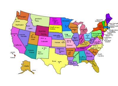
U.S. Mapping Games:
Click to start here with a simple tutorial Drag and Drop by Region Drag and Drop Click on the State Drag and Drop (Harder) To help you review, try some of the following (remember passwords given in class, or check to see if your school subscribes to solpass or quia): Geographic Regions Millionare Game Geographic Regions Match Game Geographic Regions Concentration Game Rivers Pop-up Quiz Rivers Match Game Rivers & Waterways Crossword

POLITICAL REGIONS
Looking for the political regions
of North America from the
Virgina Standards of Learning
for U. S. History 2?


HISTORY ONLINE 24/7/365
mrbower.com
THE U.S. 1 GEOGRAPHY PAGE
Geography in U. S. History 1
When I taught U.S. History 1, one of the most challenging parts of the course for many students was the geography, most specifically the physical regions of North America. While the concept of regions to group similar areas that share similar charactaristics is important, sometimes how we draw up the regions or what charactaristics we emphasise can seem arbitrary or random, and the way the Virginia SOL does this can seem very random. This is an area U.S.1 students need to spend some extra time, but understanding the geography and climate of various regions of North America will help you understand the history, and how and why areas of the United States grew and developed the way they did.Resources:
CLICK HERE to get the “official map” from the Virginia Department of Education. TIP ONE: When you look at the offical map, you will notice the regions are labeled from nearest to farthest, from east to west, or from right to left. While I understand the logic behind that approach, we read from left to right, and when I started teaching it that way, students did far better memorizing the regions in order. TIP TWO: Use a mnemonic device or memory trick to help you remember the regions in order. The one that worked best for my students was: “Can Bill Remember Girls In Carolina Are Cute” and the first letter of each word was the first letter for a region from left to right: * Coastal Range * Basin & Range * Rocky Mountains * Great Plains * Interior Lowlands * Canadian Shield * Appalachian Mountains or Highlands * Coastal Plain TIP THREE: To keep from mixing up Coastal Range and Coastal Plain, remeber Pacific beaches are rocky and hilly like a mountain “Range” and Atlantic beaches are sandy and flat like a “plain.”Click Here to go to Videos:
SOL Info:
Continents are large land masses surrounded by water. Continents • North America • South America • Africa • Asia • Australia • Antarctica • Europe* *Note: Europe is considered a continent even though it is not entirely surrounded by water. The land mass is frequently called Eurasia. Oceans • Atlantic Ocean • Pacific Ocean • Arctic Ocean • Indian Ocean • Southern Ocean Geographic regions have distinctive characteristics. Geographic regions’ locations and physical characteristics • Coastal Plain o Located along the Atlantic Ocean and Gulf of Mexico o Broad lowlands, providing many excellent harbors • Appalachian Mountains o Located west of the Coastal Plain, extending from eastern Canada to western Alabama; includes the Piedmont o Old, eroded mountains (oldest mountain range in North America) • Canadian Shield o Wrapped around the Hudson Bay in a horseshoe shape o Hills worn by erosion and hundreds of lakes carved by glaciers • Interior Lowlands o Located west of the Appalachian Mountains and east of the Great Plains o Rolling flatlands with many rivers, broad river valleys, and grassy hills • Great Plains o Located west of the Interior Lowlands and east of the Rocky Mountains o Flat lands that gradually increase in elevation westward; grasslands • Rocky Mountains o Located west of the Great Plains and east of the Basin and Range o Rugged mountains stretching from Alaska almost to Mexico; high elevations o Contains the Continental Divide, which determines the directional flow of rivers • Basin and Range o Located west of the Rocky Mountains and east of the Coastal Range o Varying elevations containing isolated mountain ranges and Death Valley, the lowest point in North America • Coastal Range o Located along the Pacific Coast, stretching from California to Canada o Rugged mountains and fertile valleys o Includes the Sierra Nevada and the Cascades The United States has access to numerous and varied bodies of water. Bodies of water support interaction among regions, form borders, and create links to other areas. Major bodies of water • Oceans: Atlantic, Pacific • Rivers: Mississippi, Missouri, Ohio, Columbia, Colorado, Rio Grande, St. Lawrence • Lakes: Great Lakes • Gulf: Gulf of Mexico Trade, transportation, exploration, and settlement • The Atlantic, Pacific, and Gulf coasts of the United States have provided access to other parts of the world. • The Atlantic Ocean served as the highway for explorers, early settlers, and later immigrants. • The Ohio River was the gateway to the west prior to the Louisiana Purchase. • Inland port cities grew in the Midwest along the Great Lakes. • The Mississippi and Missouri rivers were used to transport farm and industrial products. They created links to United States ports and other parts of the world. • The Columbia River was explored by Lewis and Clark. • The Colorado River was explored by the Spanish. • The Rio Grande forms part of the border with Mexico. • The Pacific Ocean was an early exploration destination as a route to Asia. • The Gulf of Mexico provided the French and Spanish with exploration routes to Mexico and other parts of America. • The St. Lawrence River forms part of the northeastern border with Canada and connects the Great Lakes to the Atlantic Ocean. It is important to recognize key geographic features on maps, diagrams, and/or photographs. Landforms and water features set the stage for and influenced the course of events in United States history. Key geographic features • Water-related o Lakes o Rivers o Tributaries o Gulfs and bays • Land-related o Mountains o Hills o Plains o Plateaus o Islands o Peninsulas Geographic features are related to • patterns of trade • locations of cities and towns • westward (frontier) movement • agricultural and fishing industries.Videos:
U.S. Mapping Games:
Click to start here with a simple tutorial Drag and Drop by Region Drag and Drop Click on the State Drag and Drop (Harder) To help you review, try some of the following (remember passwords given in class, or check to see if your school subscribes to solpass or quia): Geographic Regions Millionare Game Geographic Regions Match Game Geographic Regions Concentration Game Rivers Pop-up Quiz Rivers Match Game Rivers & Waterways Crossword

POLITICAL REGIONS
Looking for the political regions of
North America from the Virgina
Standards of Learning for U. S.
History 2?